

GENERAL INFORMATION
GT3 LAVAREDO – Gravel Cross Triathlon
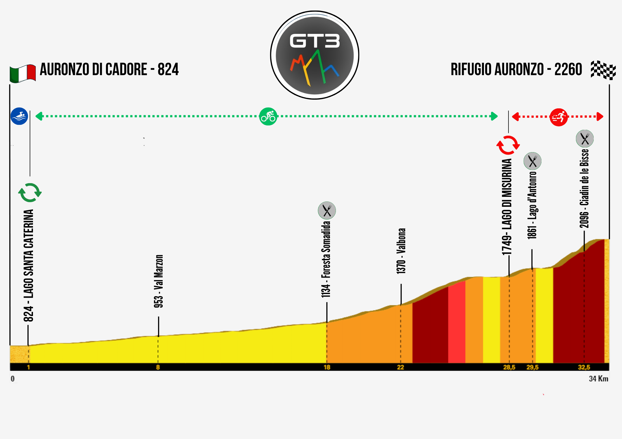
Here is the GT3 LAVAREDO Gravel Cross Triathlon map.
This mountain triathlon in Italy takes place in three key locations, which also correspond to the three race legs.
Auronzo di Cadore is the start and finish of the swimming leg, and the start of the cycling leg; the swimming leg takes place in Lake Santa Caterina.
Lake Misurina is the finish of the cycling leg and the start of the running leg.
The Tre Cime di Lavaredo, and specifically the Auronzo Hut, are the finish of the running leg.
In the images you can also see the three refreshment points at:
– Somadida Forest, in the cycling leg and at the T1 transition;
– Lake d’Antorno, in the running leg;
– Ciadin de le Bisse, in the running leg.

Here is the elevation profile of the entire course of this cross triathlon in the Dolomites.
Start: 824 m.
Swimming leg: 824 m.
Cycling leg: from Auronzo di Cadore, 824 m, to Lake Misurina, 1749 m. Passing through Val Marzon, 953 m, Somadida Forest, 1134 m, and Valbona, 1370 m.
Running leg: from Lake Misurina, 1749 m, to the Auronzo Hut (Tre Cime), 2260 m. Passing through Lake d’Antorno, 1861 m, and Ciadin de le Bisse, 2096 m.
Finish: Auronzo Hut (Tre Cime), 2260 m.